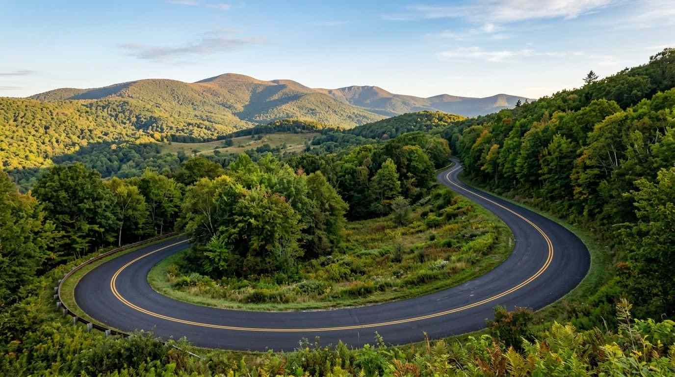
Threading through the high-altitude wilderness surrounding Grayson Highlands State Park and Mount Rogers, the Whitetop Mountain and Route 603 motorcycle guide covers one of Virginia’s most elevated secondary backroad routes. Connecting Troutdale to Route 58 and Whitetop Community, Virginia Route 603 offers a quiet, highly technical ride featuring dense hardwood canopy tunnels, tight creek-side S-curves, and dramatic vistas of Virginia’s highest peaks. Serving as an essential connector for backcountry explorers seeking technical cornering away from major highway traffic, Route 603 delivers pure Appalachian mountain riding.
Key Riding Highlights & Route 603 Backcountry Conditions
Navigating the high elevation and narrow asphalt of Route 603 requires focused technical skill and road surface awareness:
- 1. Master Tight Technical S-Curves and Shaded Creek Bed Turns:
Route 603 features narrow two-lane pavement with minimal shoulder margins. Cornering requires precise trail braking and smooth throttle control through shaded turns where moisture from mountain streams often lingers. - 2. Watch for Unpaved Gravel Runoff and Farm Entrances:
Secondary mountain roads in Grayson and Smyth counties feature numerous unpaved forestry access lanes and farm driveways. Gravel and small mountain stones frequently accumulate near turn apexes, particularly after heavy rains. - 3. High-Elevation Wildlife Density and Free-Range Ponies:
Positioned right at the boundary of Grayson Highlands, Route 603 sees heavy wildlife activity including whitetail deer, black bears, and stray livestock. Maintain conservative speeds around blind forest corners. - 4. Limited Cell Service and Remote Mountain Navigation:
Due to the deep mountain topography surrounding Whitetop Mountain, cellular signals are spotty or non-existent. Download offline mapping or carry physical backcountry maps before leaving main highways.
Before tackling isolated high-elevation secondary routes, complete a full mechanical pre-ride inspection using the complete pretrip motorcycle maintenance guide. Check cold tire inflation and tread depth for narrow mountain curves using motorcycle tire pressure and tread maintenance for mountain curves and slick asphalt. If connecting to major southern border routes, review route 58 southwest virginia motorcycle ride guide.
Conclusion: Virginia’s High-Country Backcountry Gem
Studying this Whitetop Mountain and Route 603 motorcycle guide equips riders to safely experience the untamed beauty of Southwest Virginia’s highest backcountry passes. Offering technical cornering, serene forest solitude, and spectacular mountain views, Route 603 is an unforgettable addition to any regional motorcycle tour.
Legal Disclaimer: This guide is provided for educational and route-planning purposes only. Always observe posted speed limits, account for rural road hazards, and ride within your capabilities.
Official & Credible Sources
- Virginia Department of Conservation and Recreation — Grayson Highlands State Park: https://www.dcr.virginia.gov
- U.S. Forest Service (USFS) — Mount Rogers National Recreation Area: https://www.fs.usda.gov/gwj
- Virginia Department of Transportation (VDOT) — Grayson & Smyth Counties Travel Alerts: https://www.virginiadot.org
Enjoyed This Guide? Explore Related Virginia Touring Resources:
- Southern Border Arteries: Ride cross-state mountain passes on route 58 southwest virginia motorcycle ride guide.
- Parkway Plateau Corridors: Experience rolling high country on blue ridge parkway plateau section motorcycle guide.
- Pre-Trip Safety: Inspect your brakes and tires before backcountry rides using the complete pretrip motorcycle maintenance guide.
- Tire Maintenance: Optimize cornering grip on narrow forest asphalt with motorcycle tire pressure and tread maintenance for mountain curves and slick asphalt.
- Technical Mountain Pass: Experience 435 technical turns on route 16 back of the dragon motorcycle guide.
Leave a Reply