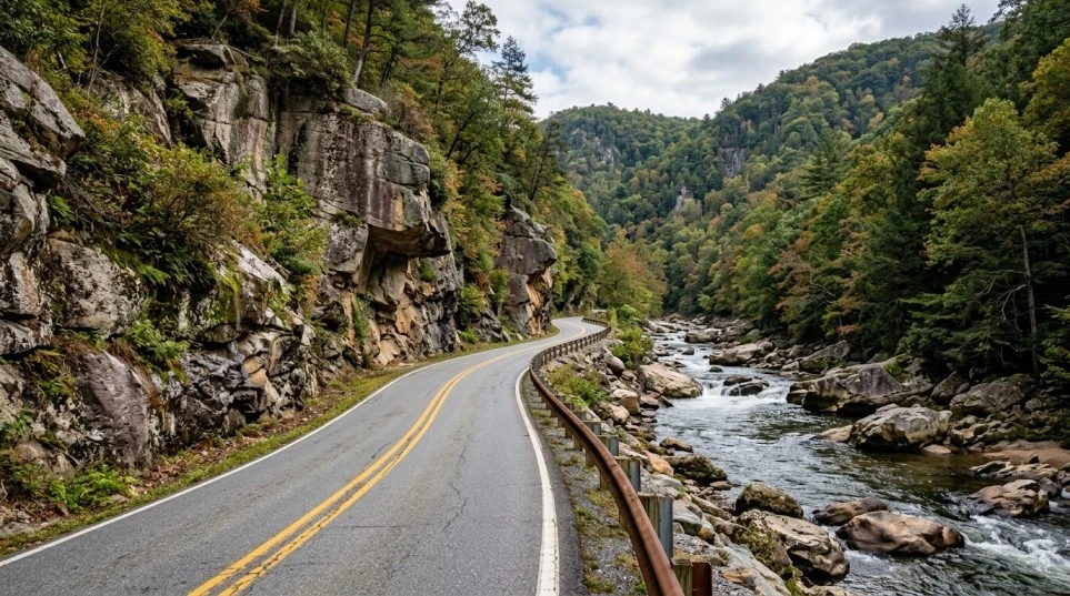
Winding through the wild, high-country landscape of Rockbridge and Bath counties, the Route 39 Virginia Highlands motorcycle guide explores one of western Virginia’s most stunning mountain corridors. Known as the Appalachian Waters Scenic Byway, Virginia Route 39 connects Lexington to the West Virginia state line near Mountain Grove, continuing on as WV 39 toward Marlinton. Highlighting the dramatic river gorge of Goshen Pass, a steady climb west toward Warm Springs, and peaceful highland valleys in Bath County, Route 39 delivers an exceptional mix of rugged natural scenery, deep river canyons, and tight technical cornering.
Key Riding Highlights & Route 39 Conditions
Tackling the river gorges and mountain passes of Route 39 requires sharp technical riding skills:
- 1. Carving the Rocky Gorge of Goshen Pass:
The eastern segment of Route 39 cuts directly through Goshen Pass, a roughly four-mile gorge carved by the Maury River. Expect tight, technical curves bounded by rock cliffs and riverbanks. Watch for damp pavement in shaded rock cuts.

- 2. Climbing West Toward Warm Springs:
West of Goshen, Route 39 climbs through a series of mountain grades on its way to Warm Springs. This section features continuous curves and elevation changes. Maintain smooth throttle control and stay within your lane on blind bends.

- 3. Watch for Falling Rock and River Debris:
Because Route 39 hugs steep rock faces along Goshen Pass and mountain cuts, loose gravel, small rocks, and seasonal water runoff can wash across the asphalt. Keep scanning far ahead around cliffside bends.

- 4. Limited Services in Remote Bath County:
Bath County is one of Virginia’s most sparsely populated regions. Cell coverage is intermittent, and gas stations are widely spaced. Fill your tank in Lexington or Warm Springs before venturing into high-elevation passes.

Before embarking on remote mountain passes, execute a full pre-ride inspection using the complete pretrip motorcycle maintenance guide. Ensure maximum edge grip for tight canyon curves with motorcycle tire pressure and tread maintenance for mountain curves and slick asphalt. If connecting to valley highways, review route 250 waynesboro to staunton motorcycle guide.
Conclusion: Western Virginia’s Rugged Mountain Masterpiece
Studying this Route 39 Virginia Highlands motorcycle guide prepares riders to take on one of the Mid-Atlantic’s finest Appalachian byways. With a dramatic river canyon, challenging mountain grades, and serene highland scenery, Route 39 is a bucket-list destination for technical motorcycle touring.
Legal Disclaimer: This guide is provided for educational and travel planning purposes only. Always observe posted speed limits, manage cornering speeds through mountain passes, and ride within your abilities.
Official & Credible Sources
- Virginia Department of Transportation (VDOT) — Bath & Rockbridge Travel Alerts: https://www.virginiadot.org
- Virginia Tourism Corporation — Virginia Highlands & Bath County Directory: https://www.virginia.org
- Bath County Tourism Authority — Warm Springs & Hot Springs Visitor Guide: https://www.resortbathcounty.com
Enjoyed This Guide? Explore Related Virginia Touring Resources:
- Valley Connectors: Tour rolling agricultural highways on route 250 waynesboro to staunton motorcycle guide.
- Hidden Mountain Loops: Explore secluded national forest roads on fort valley and massanutten mountain motorcycle loop guide.
- Pre-Trip Maintenance: Perform mechanical checks before backcountry rides using the complete pretrip motorcycle maintenance guide.
- Tire Maintenance: Optimize cold tire pressure for canyon curves with motorcycle tire pressure and tread maintenance for mountain curves and slick asphalt.
- Mountain Pass Access: Experience dual-lane climbs on us route 33 swift run gap motorcycle guide.
Leave a Reply