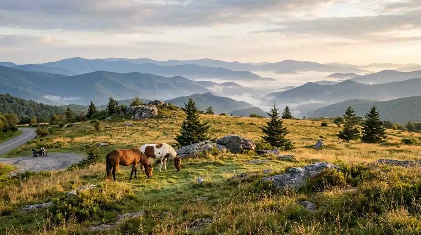
Grayson County sits in the far southwest corner of Virginia, near the state’s highest peak, which makes this Grayson County and Mount Rogers motorcycle guide a useful planning tool for riders who want high-country scenery without a long trip off the main road. The area is known for Grayson Highlands State Park, the Mount Rogers National Recreation Area, and the winding stretch of US Route 58 that links Independence with Damascus. It is a quiet region, so plan fuel and meals ahead.
Key Riding Highlights in Grayson County and the Mount Rogers Area
1. Ride US Route 58, the Highlands Parkway
US Route 58 crosses Grayson County between Independence and Damascus, and the section near Mouth of Wilson carries the name Highlands Parkway. The road follows valleys and low ridges, with curves that suit relaxed touring. For the longer route, see the Route 58 Southwest Virginia motorcycle ride guide.
2. Turn Onto VA 362 to Grayson Highlands State Park
Near Mouth of Wilson, VA 362 leaves US 58 and leads about two miles into Grayson Highlands State Park. The park sits high in the Blue Ridge and is known for its open balds, cool air, and roaming wild ponies. An entrance fee applies, so check current fees and gate hours before you go.
3. See Mount Rogers from the Highlands
Mount Rogers is the highest point in Virginia, and the park provides the main trail access to its summit. Riders will not reach the summit by motorcycle, but the views from the park roads and overlooks give a strong sense of the high country.
4. Combine the Ride with Whitetop Mountain
Whitetop Mountain, Virginia’s second-highest peak, lies within a short drive of Mouth of Wilson. Read the Whitetop Mountain and Route 603 motorcycle guide to build a loop that covers both areas.
Safety Tips for Grayson County and the Mount Rogers Area
Wild Ponies and Free-Range Animals
Wild ponies and free-range cattle roam parts of the Highlands, especially near the park and trailheads. Slow down, give animals plenty of space, and never feed or approach the ponies.
Sudden Mountain Weather
Temperatures at elevation can be much cooler than in the valley, and fog, wind, or rain can arrive quickly. Carry layers and rain gear, and reduce speed on wet pavement.
Limited Services
Gas stations and restaurants are limited near Mouth of Wilson and the park. Fill your tank before you leave Independence, Damascus, or another larger town, and bring water.
Park Hours and Parking
Grayson Highlands State Park has an entrance gate with seasonal hours, and popular parking areas can fill on weekends and during fall color. Check the park’s website before you go.
Prepare Before You Ride
Mountain curves and long descents are hard on tires and brakes, so review motorcycle tire pressure and tread maintenance for mountain curves and slick asphalt before you leave. Check the forecast for the highlands, because conditions there can differ from the valley.
Conclusion: A High-Country Corner of Virginia
Grayson County and the Mount Rogers area give riders quiet mountain highways, a state park with wild ponies, and quick access to Whitetop Mountain. Plan fuel and layers, watch for animals and weather, and ride within your limits to enjoy one of Virginia’s most distinctive regions.
Legal Disclaimer: This guide is provided for educational and route-planning purposes only. Always observe posted speed limits, check current road and weather conditions, and ride within your capabilities.
Official & Credible Sources
- Virginia Department of Transportation (VDOT), Road Conditions & Travel Updates: https://www.virginiadot.org
- Virginia State Parks, Grayson Highlands State Park: https://www.dcr.virginia.gov/state-parks/grayson-highlands
- U.S. Forest Service (USFS), George Washington & Jefferson National Forests: https://www.fs.usda.gov/gwj
Enjoyed This Guide? Explore Related Virginia Touring Resources
- Alpine Highlands: Explore the Highland County maple and mountain loop guide.
- More Highlands Touring: Try the Route 39 Virginia Highlands motorcycle guide.
- Ridge Road Twists: Read the Clinch Mountain and Route 80 motorcycle guide.
- Technical Mountain Riding: Study the Snake Route 421 motorcycle guide.
- Parkway Plateau: Continue on the Blue Ridge Parkway plateau section motorcycle guide.
Leave a Reply