Author: LEDJ EDEL

  • Breaks Roaring Plains & Route 83 Motorcycle Guide (2026)

    Breaks Roaring Plains & Route 83 Motorcycle Guide (2026)

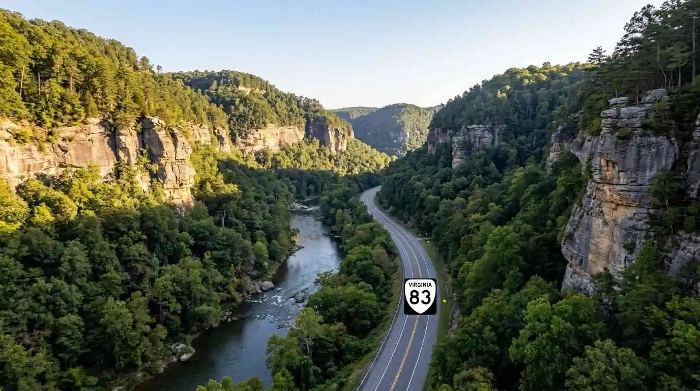
    Winding through the deep, dramatic coalfield canyons of Buchanan and Dickenson counties toward the Kentucky border, the Breaks Roaring Plains and Route 83 motorcycle guide covers one of the most rugged Appalachian routes in Virginia. Centered around Virginia Route 83 and providing direct access to Breaks Interstate Park—known as the “Grand Canyon of the South”—this corridor cuts through thousand-foot sandstone gorges carved by the Russell Fork River. Featuring tight cliffside turns, sweeping river valley curves, and rich regional coal heritage, Route 83 delivers a unique combination of technical cornering and majestic geological scenery.

    Key Riding Highlights & Route 83 Canyon Conditions

    Navigating the cliffside curves and coalfield highways of Route 83 requires specific road awareness:

    • 1. Carving the Sandstone Gorges Near Breaks Interstate Park:
      Approaching the park boundary on Route 83 and Route 80 features dramatic elevation changes and tight turns bounded by sheer rock bluffs. Enjoy sweeping views of the Russell Fork gorge while maintaining steady throttle control through blind curves.
    • 2. Watch for Coal Hauling Trucks and Commercial Transport:
      Route 83 is a key commercial artery for coalfield communities like Grundy and Vansant. Be prepared for slow-moving coal trucks on steep grades and maintain extra space when following heavy vehicles around narrow turns.
    • 3. Mind Loose Coal Dust and Gravel in Turn Apexes:
      Industrial transport along coalfield routes occasionally leaves fine coal dust or loose gravel near road shoulders and intersections. Reduce lean angles slightly on corners near active hauling access lanes.
    • 4. Sharp Moisture Retention in Deep River Canyons:
      Because the steep sandstone walls block direct sunlight in the deep river cuts, pavement near Russell Fork can remain cold and damp well into midday. Exercise care on shaded rock curves.

    Before venturing into remote coalfield canyons, perform a complete pre-ride mechanical inspection using the complete pretrip motorcycle maintenance guide. Check cold tire pressure and tread depth for mountain canyon asphalt with motorcycle tire pressure and tread maintenance for mountain curves and slick asphalt. If connecting to southern crest passes, review clinch mountain and route 80 motorcycle guide.

    Conclusion: The Grand Canyon of the South Byway

    Studying this Breaks Roaring Plains and Route 83 motorcycle guide arms riders with essential road insights to safely explore Virginia’s coalfield canyon country. Offering breathtaking sandstone gorge vistas, technical river curves, and rich cultural history, Route 83 is a highlight of any far-west Virginia tour.

    Legal Disclaimer: This guide is provided for educational and route-planning purposes only. Always observe posted speed limits, yield to commercial transport, and ride within your capabilities.

    Official & Credible Sources


    Enjoyed This Guide? Explore Related Virginia Touring Resources:

    1. Mountain Crest Passes: Climb technical switchbacks on clinch mountain and route 80 motorcycle guide.
    2. Valley Bowl Passes: Tour secluded mountain bowls on burkes garden motorcycle ride guide.
    3. Pre-Trip Safety: Inspect your motorcycle before canyon rides using the complete pretrip motorcycle maintenance guide.
    4. Tire Maintenance: Optimize rubber traction for shaded gorge asphalt with motorcycle tire pressure and tread maintenance for mountain curves and slick asphalt.
    5. Technical Mountain Pass: Experience 435 technical turns on route 16 back of the dragon motorcycle guide.
  • Clinch Mountain & Route 80 Motorcycle Guide: VA Pass (2026)

    Clinch Mountain & Route 80 Motorcycle Guide: VA Pass (2026)

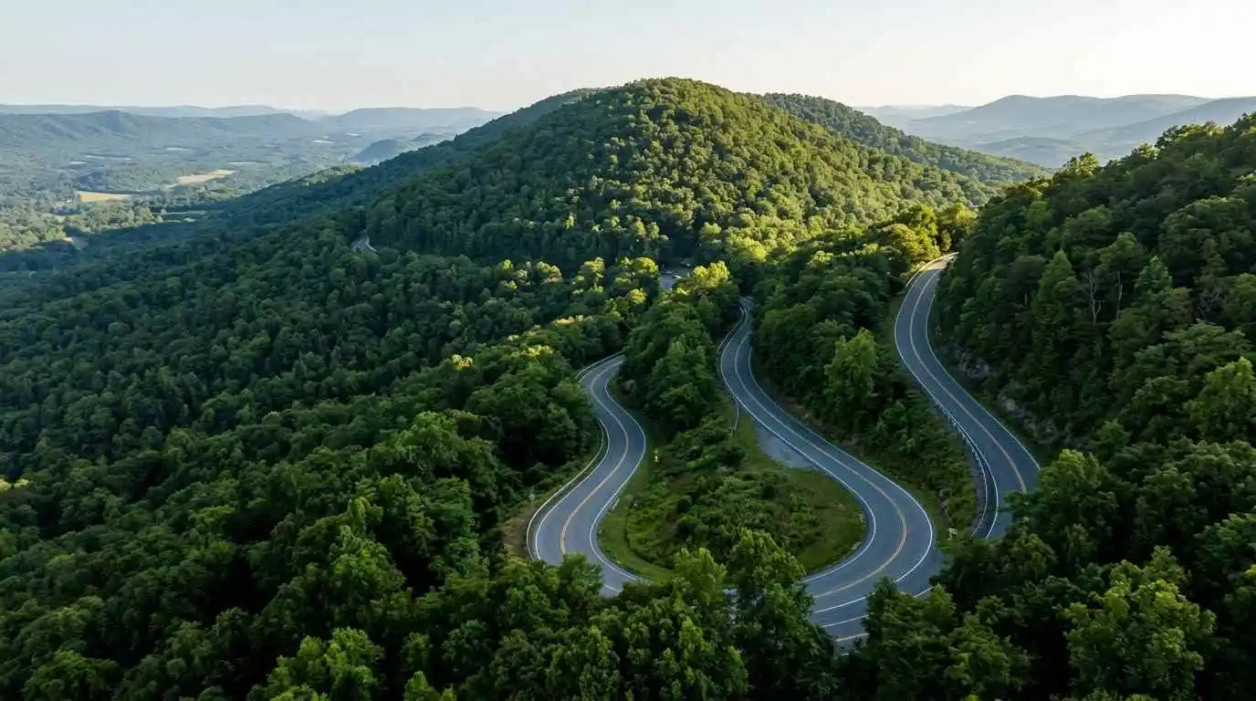
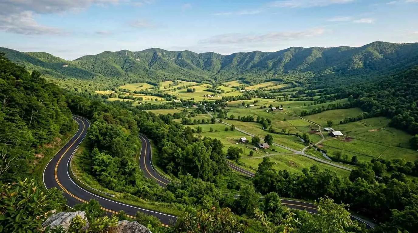
    Crossing the formidable ridge of Clinch Mountain through Hayters Gap, the Clinch Mountain and Route 80 motorcycle guide highlights one of Southwest Virginia’s most technically demanding mountain pass routes. Connecting Meadowview in Washington County to Rosedale and Honaker in Russell County, Virginia Route 80 features rapid elevation gains, tight S-curves, and sequential Hairpin turns. Bounded by dense forest canopies and steep rock drops, Route 80 delivers a pure, unadulterated technical mountain riding experience for riders exploring the Appalachian heartland.

    Key Riding Highlights & Route 80 Mountain Pass Conditions

    Navigating the steep switchbacks and narrow pavement of Route 80 over Hayters Gap demands sharp technical skill:

    • 1. Master Technical Switchbacks on Hayters Gap Climb:
      The ascent up Clinch Mountain features severe, back-to-back hairpin turns with steep incline gradients. Focus on smooth throttle control, precise trail braking, and keeping head eyes turned through blind uphill apexes.
    • 2. Watch for Gravel Runoff and Damp Mountain Asphalt:
      Heavy mountain rainfall and winter runoff frequently carry loose gravel from steep embankments onto the road surface. Additionally, thick forest shade retains damp patches in turn apexes long into the day.
    • 3. Tight Lane Margins and Limited Shoulder Space:
      Route 80 is a narrow two-lane corridor with sharp drop-offs and guardrails close to the white line. Maintain strict lane discipline and avoid crowding the center line on blind right-hand curves.
    • 4. Watch for Coal and Agricultural Trucks:
      As a key regional connector between Washington and Russell counties, local commercial transport and farm trucks occasionally use the pass. Anticipate slow-moving vehicles around tight mountain turns.

    Before tackling tight mountain pass switchbacks, perform a complete mechanical check using the complete pretrip motorcycle maintenance guide. Check cold tire pressure and tread depth for steep mountain asphalt with motorcycle tire pressure and tread maintenance for mountain curves and slick asphalt. If combining your tour with neighboring valley bowls, review burkes garden motorcycle ride guide.

    Conclusion: A Classic Appalachian Technical Crest

    Studying this Clinch Mountain and Route 80 motorcycle guide prepares riders to confidently handle one of Virginia’s finest ridge crossings. Offering dramatic technical turns, pristine forest scenery, and rich regional history, Route 80 is a must-ride leg for mountain pass enthusiasts.

    Legal Disclaimer: This guide is provided for educational and route-planning purposes only. Always observe posted speed limits, manage cornering speeds through mountain passes, and ride within your capabilities.

    Official & Credible Sources


    Enjoyed This Guide? Explore Related Virginia Touring Resources:

    1. Valley Bowl Passes: Climb steep gaps on burkes garden motorcycle ride guide.
    2. Technical Mountain Curves: Ride 435 mountain turns on route 16 back of the dragon motorcycle guide.
    3. Pre-Trip Safety Inspection: Inspect your motorcycle systems using the complete pretrip motorcycle maintenance guide.
    4. Tire Maintenance: Maximize rubber grip on steep switchbacks with motorcycle tire pressure and tread maintenance for mountain curves and slick asphalt.
    5. Highland Backcountry Routes: Tour high mountain gaps on whitetop mountain and route 603 motorcycle guide.

  • Burkes Garden Motorcycle Ride Guide: VA Valley Bowl (2026)

    Burkes Garden Motorcycle Ride Guide: VA Valley Bowl (2026)

    Nestled within a massive, natural mountain bowl in Tazewell County often referred to as “God’s Thumbprint,” the Burkes Garden motorcycle ride guide explores one of Virginia’s most geographically unique agricultural valleys. Accessing this high-altitude bowl via Virginia Route 623 requires conquering a steep, winding mountain pass before descending into a tranquil, 10-mile-wide rural paradise ringed entirely by Garden Mountain. Offering sharp switchbacks on the mountain pass and peaceful, zero-traffic agricultural loops on the valley floor, Burkes Garden delivers a memorable combination of technical climbing and serene rural touring.

    Key Riding Highlights & Burkes Garden Conditions

    Navigating the steep mountain gap and quiet valley floor of Burkes Garden requires awareness of rural road hazards:

    • 1. Master Technical Switchbacks on Route 623 Gap Pass:
      The mountain pass over Garden Mountain on Route 623 features tight, low-speed switchbacks with steep elevation gradients. Smooth clutch modulation and precise rear-brake trail braking are essential on tight uphill turn entries.
    • 2. Mind Free-Range Farm Equipment and Unpaved Driveways:
      Burkes Garden is an active, traditional farming community. Expect slow-moving tractors, cattle crossings, and loose gravel kicked onto turn apexes near farm lane entrances.
    • 3. Watch for Livestock and Wildlife on Valley Roads:
      With wide pasture lands framed by mountain timber, whitetail deer, wild turkeys, and farm animals frequently roam near or across the paved valley loop roads. Keep speeds modest inside the bowl.
    • 4. One-Way Access Point and Limited Services:
      Route 623 is the primary paved access route into the bowl. Gasoline and commercial services inside the garden are non-existent. Fill your fuel tank in nearby Tazewell or Marion before ascending the mountain pass.

    Before climbing steep mountain gap passes, execute a full mechanical pre-ride inspection using the complete pretrip motorcycle maintenance guide. Ensure correct cold tire pressure and tread depth for tight switchbacks using motorcycle tire pressure and tread maintenance for mountain curves and slick asphalt. If combining your tour with neighboring technical pass routes, review route 16 back of the dragon motorcycle guide.

    Conclusion: Virginia’s High-Country Valley Oasis

    Studying this Burkes Garden motorcycle ride guide prepares riders to discover one of the Mid-Atlantic’s most breathtaking hidden valleys. With technical gap switchbacks, pristine farm vistas, and unmatched tranquility, Burkes Garden is a premier destination for backcountry touring riders.

    Legal Disclaimer: This guide is provided for educational and route-planning purposes only. Always observe posted speed limits, yield to agricultural machinery, and ride within your capabilities.

    Official & Credible Sources


    Enjoyed This Guide? Explore Related Virginia Touring Resources:

    1. Technical Mountain Passes: Ride 435 mountain turns on route 16 back of the dragon motorcycle guide.
    2. Highland Backcountry Routes: Explore high-elevation passes on whitetop mountain and route 603 motorcycle guide.
    3. Pre-Trip Safety: Inspect your motorcycle systems using the complete pretrip motorcycle maintenance guide.
    4. Tire Maintenance: Maintain edge grip on steep switchbacks using motorcycle tire pressure and tread maintenance for mountain curves and slick asphalt.
    5. Southern Border Arteries: Experience cross-state mountain highways on route 58 southwest virginia motorcycle ride guide.

  • Whitetop Mountain & Route 603 Motorcycle Guide (2026)

    Whitetop Mountain & Route 603 Motorcycle Guide (2026)

    Threading through the high-altitude wilderness surrounding Grayson Highlands State Park and Mount Rogers, the Whitetop Mountain and Route 603 motorcycle guide covers one of Virginia’s most elevated secondary backroad routes. Connecting Troutdale to Route 58 and Whitetop Community, Virginia Route 603 offers a quiet, highly technical ride featuring dense hardwood canopy tunnels, tight creek-side S-curves, and dramatic vistas of Virginia’s highest peaks. Serving as an essential connector for backcountry explorers seeking technical cornering away from major highway traffic, Route 603 delivers pure Appalachian mountain riding.

    Key Riding Highlights & Route 603 Backcountry Conditions

    Navigating the high elevation and narrow asphalt of Route 603 requires focused technical skill and road surface awareness:

    • 1. Master Tight Technical S-Curves and Shaded Creek Bed Turns:
      Route 603 features narrow two-lane pavement with minimal shoulder margins. Cornering requires precise trail braking and smooth throttle control through shaded turns where moisture from mountain streams often lingers.
    • 2. Watch for Unpaved Gravel Runoff and Farm Entrances:
      Secondary mountain roads in Grayson and Smyth counties feature numerous unpaved forestry access lanes and farm driveways. Gravel and small mountain stones frequently accumulate near turn apexes, particularly after heavy rains.
    • 3. High-Elevation Wildlife Density and Free-Range Ponies:
      Positioned right at the boundary of Grayson Highlands, Route 603 sees heavy wildlife activity including whitetail deer, black bears, and stray livestock. Maintain conservative speeds around blind forest corners.
    • 4. Limited Cell Service and Remote Mountain Navigation:
      Due to the deep mountain topography surrounding Whitetop Mountain, cellular signals are spotty or non-existent. Download offline mapping or carry physical backcountry maps before leaving main highways.

    Before tackling isolated high-elevation secondary routes, complete a full mechanical pre-ride inspection using the complete pretrip motorcycle maintenance guide. Check cold tire inflation and tread depth for narrow mountain curves using motorcycle tire pressure and tread maintenance for mountain curves and slick asphalt. If connecting to major southern border routes, review route 58 southwest virginia motorcycle ride guide.

    Conclusion: Virginia’s High-Country Backcountry Gem

    Studying this Whitetop Mountain and Route 603 motorcycle guide equips riders to safely experience the untamed beauty of Southwest Virginia’s highest backcountry passes. Offering technical cornering, serene forest solitude, and spectacular mountain views, Route 603 is an unforgettable addition to any regional motorcycle tour.

    Legal Disclaimer: This guide is provided for educational and route-planning purposes only. Always observe posted speed limits, account for rural road hazards, and ride within your capabilities.

    Official & Credible Sources


    Enjoyed This Guide? Explore Related Virginia Touring Resources:

    1. Southern Border Arteries: Ride cross-state mountain passes on route 58 southwest virginia motorcycle ride guide.
    2. Parkway Plateau Corridors: Experience rolling high country on blue ridge parkway plateau section motorcycle guide.
    3. Pre-Trip Safety: Inspect your brakes and tires before backcountry rides using the complete pretrip motorcycle maintenance guide.
    4. Tire Maintenance: Optimize cornering grip on narrow forest asphalt with motorcycle tire pressure and tread maintenance for mountain curves and slick asphalt.
    5. Technical Mountain Pass: Experience 435 technical turns on route 16 back of the dragon motorcycle guide.
  • Route 58 Southwest Virginia Motorcycle Ride Guide (2026)

    Route 58 Southwest Virginia Motorcycle Ride Guide (2026)

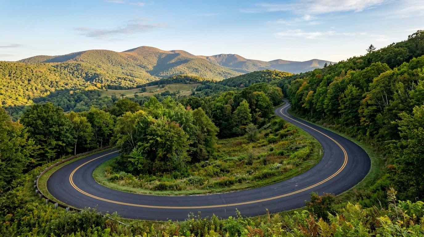
    Spanning the entire southern border of the Commonwealth, the Route 58 Southwest Virginia motorcycle ride guide explores one of the state’s most diverse long-distance mountain arteries. Stretching from the historic artisan hub of Abingdon through Damascus, Volney, and Hillsville, US Route 58 weaves through the heart of the Mount Rogers National Recreation Area. Serving as the spine of Virginia’s Crooked Road heritage trail, Route 58 combines long multi-lane climbing sweeps, tight technical mountain passes, and historic small-town stops into an essential Appalachian touring experience.

    Key Riding Highlights & Route 58 Road Conditions

    Navigating the long mountain ascents and varied terrain of Route 58 requires focused road management:

    • 1. Master Technical Mountain Sweepers Near Mount Rogers:
      Between Damascus and Volney, Route 58 climbs close to Mount Rogers—Virginia’s highest peak. This mountain stretch features dense series of technical turns, elevation drops, and sharp S-curves bounded by heavy timberlines.
    • 2. Crooked Road Cultural Heritage and Slow-Moving Local Traffic:
      As a celebrated cultural highway, Route 58 connects historic music venues and country stores. Expect slow-moving tourist traffic, farm machinery entering from rural access roads, and logging trucks on mountain grades.
    • 3. Watch for Sudden Mountain Weather and Elevation Shifts:
      Elevations along Route 58 fluctuate significantly. Mountain gaps above 3,000 feet can trap heavy fog and sudden cloud bursts while valley floors remain clear. Pack versatile riding layers and adjust speed for low visibility.
    • 4. Mind Changing Lane Configurations:
      Route 58 transitions frequently between wide four-lane divided stretches and narrow two-lane mountain passes. Pay close attention to lane reduction signs and changing speed limits near town intersections.

    Before setting out on long cross-state mountain routes, perform a comprehensive mechanical check using the complete pretrip motorcycle maintenance guide. Verify cold tire inflation pressure and tread depth for mountain curves with motorcycle tire pressure and tread maintenance for mountain curves and slick asphalt. If connecting to national parkways along the plateau, review blue ridge parkway plateau section motorcycle guide.

    Conclusion: Virginia’s Southern Mountain Backbone

    Studying this Route 58 Southwest Virginia motorcycle ride guide prepares riders to experience the rugged beauty and rich heritage of Virginia’s southern highlands. Offering endless cornering variety, majestic mountain views, and historic cultural stops, Route 58 is a cornerstone of any Virginia touring journey.

    Legal Disclaimer: This guide is provided for educational and route-planning purposes only. Always observe posted speed limits, adjust speed for weather conditions, and ride within your capabilities.

    Official & Credible Sources


    Enjoyed This Guide? Explore Related Virginia Touring Resources:

    1. Parkway Plateau Corridors: Connect to scenic high-country highways on blue ridge parkway plateau section motorcycle guide.
    2. Northern Parkway Ridge: Ride national parkway crests on blue ridge parkway ridge section motorcycle guide.
    3. Pre-Trip Safety Inspection: Perform essential checks before long rides using the complete pretrip motorcycle maintenance guide.
    4. Tire Maintenance: Maintain edge grip for mountain passes using motorcycle tire pressure and tread maintenance for mountain curves and slick asphalt.
    5. Technical Mountain Pass: Master 435 technical curves on route 16 back of the dragon motorcycle guide.
  • Blue Ridge Parkway Plateau Section Motorcycle Guide (2026)

    Blue Ridge Parkway Plateau Section Motorcycle Guide (2026)

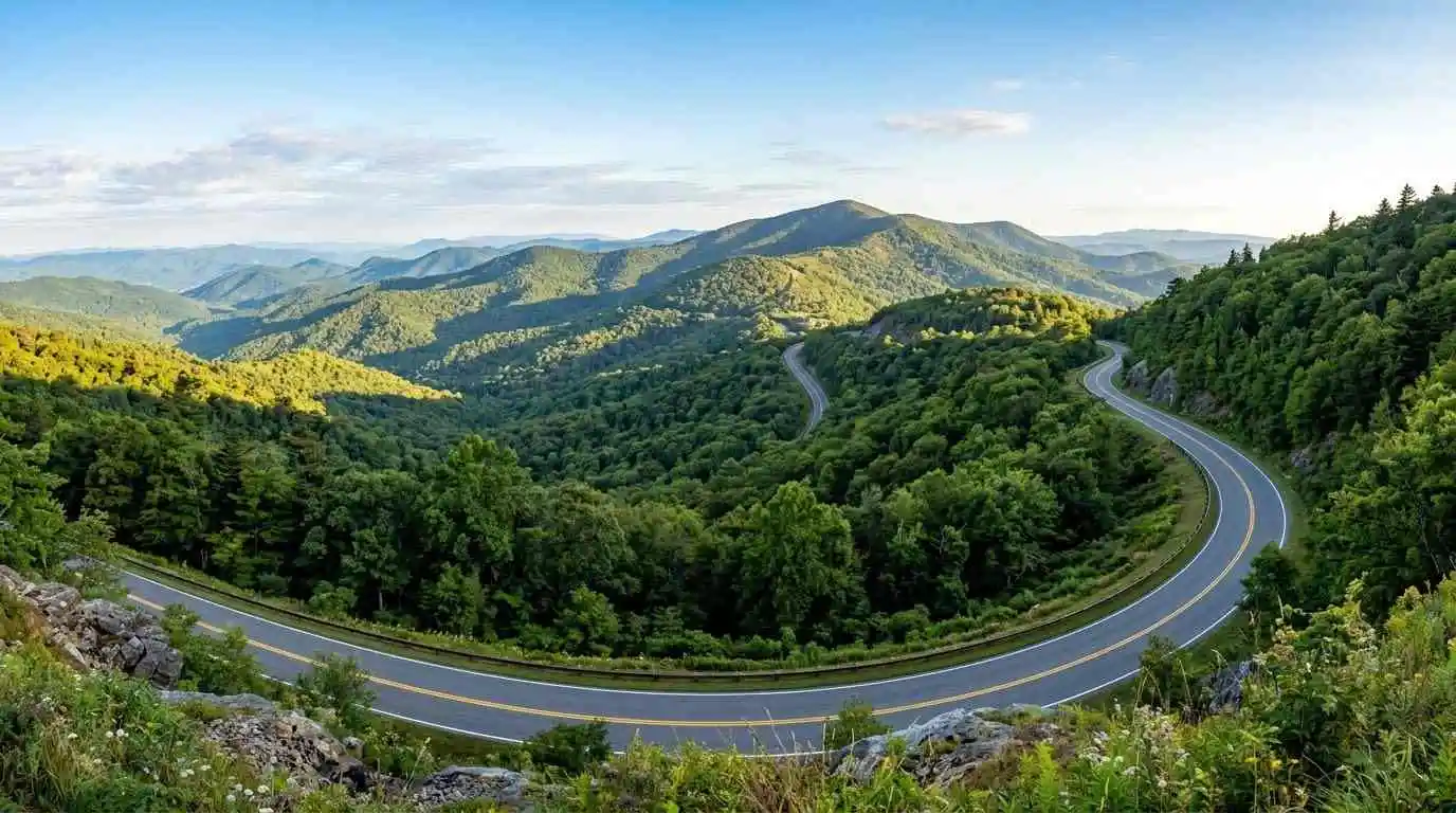
    Stretching south from the Roanoke Valley toward Fancy Gap and Galax, the Blue Ridge Parkway Plateau Section motorcycle guide explores the rolling high-country tablelands of southwestern Virginia. Unlike the rugged, cliffside ridges of the northern sections, the Plateau Section features gently undulating curves, open agricultural pastures, historic timber structures like Mabry Mill (Milepost 176), and panoramic views of the Blue Ridge escarpment. Offering a relaxed, fluid touring rhythm, this segment is renowned for its cultural heritage, traditional music hubs, and peaceful countryside riding.

    Key Riding Highlights & Plateau Section Conditions

    Enjoying the open pastures and rolling curves of the high plateau requires attention to regional road characteristics and rural activity:

    • 1. Enjoying Gentle Sweepers and Rolling Cadence:
      The geography of the Floyd Plateau offers wide, open curves with outstanding line-of-sight visibility. The relaxed topography allows for smooth, sweeping lean angles and a stress-free riding pace within the posted 45 mph parkway speed limit.
    • 2. Historic Cultural Stops and Sightseer Traffic:
      Iconic landmarks such as Mabry Mill, Groundhog Mountain, and nearby Floyd draw significant tourist traffic. Expect slow-moving vehicles, campers entering and exiting parking areas, and sudden braking around designated scenic pull-offs.
    • 3. Rural Agricultural Crossings and Free-Range Livestock:
      The parkway traverses rural farming communities along the plateau. Watch for agricultural machinery crossing at designated farm access roads and keep an eye out for farm animals near pasture fence lines.
    • 4. Rapid Fog Accumulation at Escarpment Edges:
      Where the high plateau drops sharply along the eastern Blue Ridge escarpment, moist air rising from the Piedmont frequently forms thick fog banks. Maintain increased following distances and utilize low-beam lighting during low-visibility conditions.

    Before setting out on long mountain plateau journeys, perform a comprehensive mechanical check using the complete pretrip motorcycle maintenance guide. Check tire pressures and tread depth for smooth parkway asphalt with motorcycle tire pressure and tread maintenance for mountain curves and slick asphalt. If connecting from the northern mountain crests, review blue ridge parkway ridge section motorcycle guide.

    Conclusion: The Heart of Virginia’s Cultural High Country

    Studying this Blue Ridge Parkway Plateau Section motorcycle guide prepares riders to experience one of the most serene and culturally rich stretches of the national parkway. Blending smooth, flowing curves with historic Appalachian landmarks, the Plateau Section is an indispensable part of any southwestern Virginia touring itinerary.

    Legal Disclaimer: This guide is provided for educational and route-planning purposes only. Always observe posted federal parkway speed limits, exercise caution around agricultural access roads, and ride within your capabilities.

    Official & Credible Sources


    Enjoyed This Guide? Explore Related Virginia Touring Resources:

    1. Northern Ridge Parkway: Ride high mountain crests on blue ridge parkway ridge section motorcycle guide.
    2. Shenandoah Extension: Experience the national park scenic highway on skyline drive southern section motorcycle guide.
    3. Pre-Trip Safety: Inspect your motorcycle before high-country trips using the complete pretrip motorcycle maintenance guide.
    4. Tire Maintenance: Maintain edge traction for smooth mountain curves with motorcycle tire pressure and tread maintenance for mountain curves and slick asphalt.
    5. Canyon Routes: Explore western river passes on route 39 goshen pass motorcycle ride guide.