Author: LEDJ EDEL

  • Blue Ridge Parkway Ridge Section Motorcycle Guide (2026)

    Blue Ridge Parkway Ridge Section Motorcycle Guide (2026)

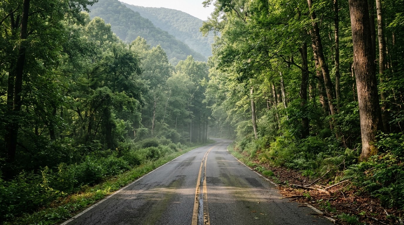
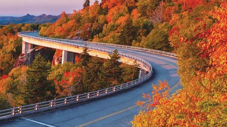
    Spanning the northernmost mountains of the national parkway from Rockfish Gap (Milepost 0) down toward the Roanoke Valley, the Blue Ridge Parkway Ridge Section motorcycle guide covers one of Eastern America’s premier scenic touring corridors. Characterized by wide, sweeping turns that hug high mountain crests, continuous valley overlooks, and historical sites like Humpback Rocks and Otter Creek, this ridge section delivers a smooth, elevated riding cadence. Operating under a steady 45 mph speed limit, the parkway offers an uninterrupted, stop-light-free journey through Virginia’s high country.

    Essential Riding Highlights & Ridge Parkway Regulations

    Navigating the northern ridge section of the Blue Ridge Parkway requires adherence to parkway rules and mountain riding awareness:

    • 1. Maintain Sustainable 45 MPH Pacing:
      Designed for leisurely scenic travel, the parkway enforces a maximum speed limit of 45 mph (frequently reduced to 35 mph near visitor centers). Federal park rangers monitor speed strictly; maintain a steady pace and utilize paved overlooks to allow faster traffic to pass safely.
    • 2. Prepare for Sudden High-Ridge Fog and Wind Gusts:
      Exposed ridge sections above 3,000 feet frequently encounter sudden cloud cover, thick mountain fog, and crosswinds. Reduce speed, increase following distances, and keep low-beam headlights active during low-visibility stretches.
    • 3. Watch for Wildlife Crossing Open Ridge Slopes:
      Whitetail deer, wild turkeys, and black bears move frequently across the parkway pavement between timberlines and ridge pastures, particularly near morning and evening twilight.
    • 4. Limited Gas Stations Directly on the Parkway:
      Fuel options on the parkway pavement are extremely limited. Plan fuel stops at major exit interchanges such as US 60 (Buena Vista / Amherst) or US 501 (Glasgow) before pushing deep into rural ridge segments.

    Before setting off on long parkway tours, perform a thorough inspection of your motorcycle’s braking and mechanical systems using the complete pretrip motorcycle maintenance guide. Check cold tire pressure and tread condition for smooth parkway asphalt with motorcycle tire pressure and tread maintenance for mountain curves and slick asphalt. If connecting from the national park to the north, review skyline drive southern section motorcycle guide.

    Conclusion: America’s Premier Scenic Ridge Highway

    Studying this Blue Ridge Parkway Ridge Section motorcycle guide arms riders with essential strategies for a seamless, breathtaking mountain journey. With panoramic valley vistas, gentle sweeping curves, and pure riding rhythm, this northern ridge section is a foundational piece of any Virginia motorcycle tour.

    Legal Disclaimer: This guide is provided for educational and route-planning purposes only. Always observe federal parkway speed limits, yield to wildlife, and exercise caution in low-visibility mountain weather.

    Official & Credible Sources


    Enjoyed This Guide? Explore Related Virginia Touring Resources:

    1. Shenandoah Connectors: Tour the national park’s southern extension on skyline drive southern section motorcycle guide.
    2. Canyon Routes: Ride nearby river gaps on route 39 goshen pass motorcycle ride guide.
    3. Pre-Trip Maintenance: Inspect your controls and brakes before parkway rides using the complete pretrip motorcycle maintenance guide.
    4. Tire Care: Maintain optimal rubber inflation for mountain ridges with motorcycle tire pressure and tread maintenance for mountain curves and slick asphalt.
    5. Highland River Valleys: Explore serene valley sweeps on route 220 highland to bath counties motorcycle guide.
  • Route 39 Goshen Pass Motorcycle Ride Guide (2026)

    Route 39 Goshen Pass Motorcycle Ride Guide (2026)

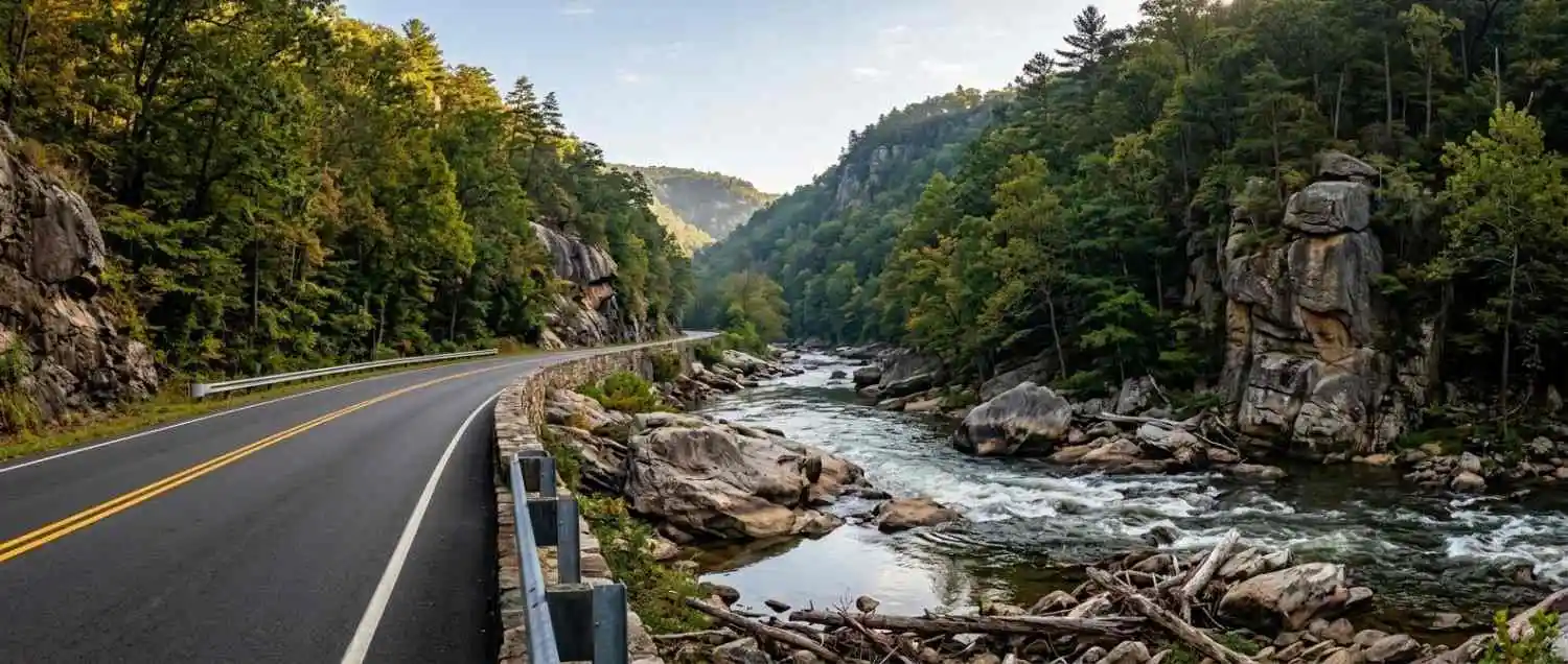
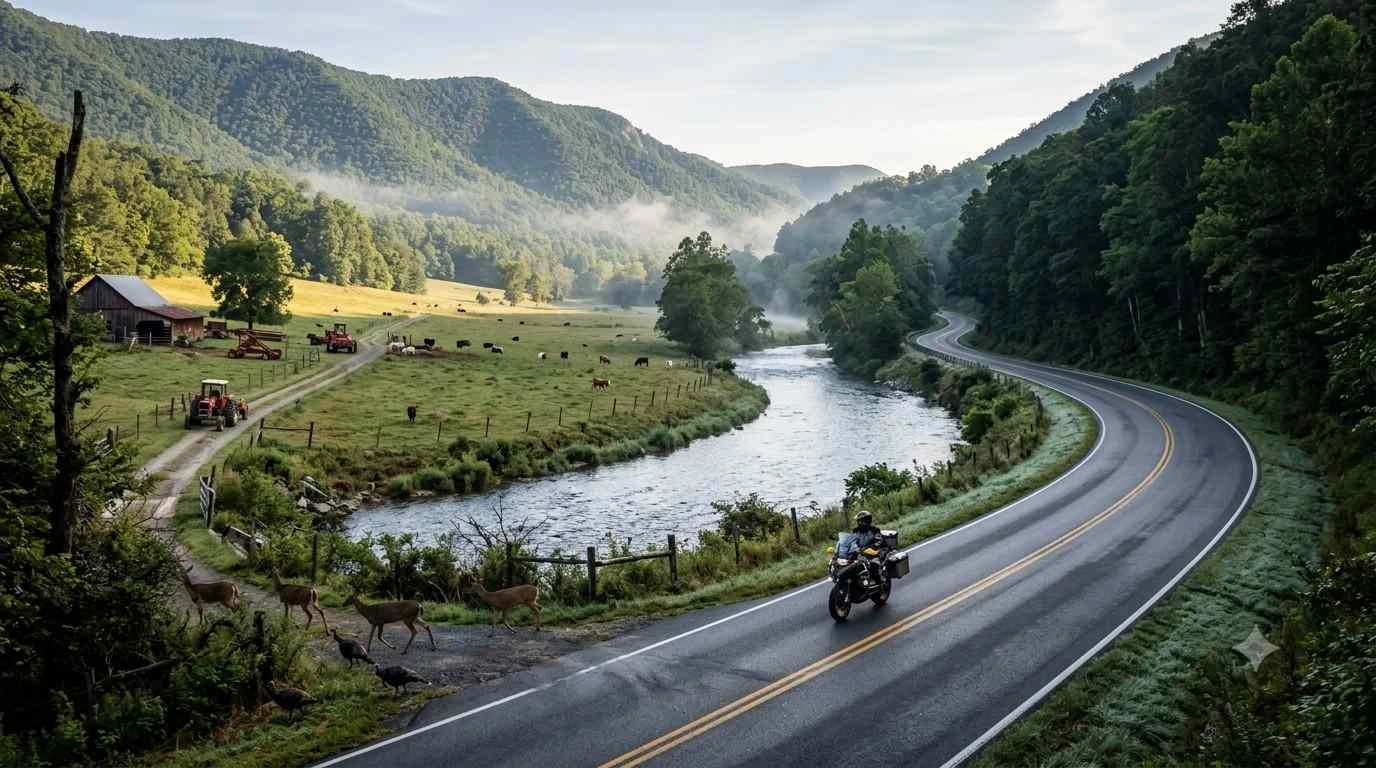
    Carving through a dramatic mountain water gap sculpted by the Maury River in Rockbridge County, the Route 39 Goshen Pass motorcycle ride guide explores one of Virginia’s most celebrated river canyon routes. Connecting Lexington and Rockbridge Baths to Warm Springs in Bath County, Virginia Route 39 delivers an exceptional blend of sweeping riverside curves, towering quartzite cliffs, and mountain forest scenery. Providing continuous technical cornering rhythm alongside pristine natural views, Goshen Pass stands out as an iconic anchor for western Virginia backroad touring.

    Key Riding Highlights & Canyon Pass Conditions

    Navigating the sharp turns and shaded asphalt of Route 39 through Goshen Pass requires specific canyon riding tactics:

    • 1. Managing River-Damp Asphalt and Deep Shadows:
      Because steep rock bluffs frame the Maury River gorge, direct sunlight reaches the road surface for only part of the day. Pavement dampness and morning condensation linger in shaded turns; adjust lean angles and smooth out throttle applications.
    • 2. Watch for Rockfall and River Gravel Hazards:
      Thermal shifts and heavy rainfall frequently dislodge small rocks and gravel from towering cliff faces onto the asphalt. Scan inner turn apexes continuously to avoid debris along mountain rock walls.
    • 3. Recreational Wayside and Pulloff Awareness:
      Goshen Pass features popular river access points for swimmers, kayakers, and hikers. Anticipate slow-moving passenger vehicles, pedestrians near gravel pulloffs, and doors opening close to the travel lane.
    • 4. Direct Connection to High-Elevation Highlands Routes:
      West of the pass, Route 39 climbs toward Warm Springs, offering seamless access to high-country corridors like Route 220 and Route 42 for multi-county Appalachian loops.

    Before tackling tight canyon turns and shaded gorges, perform a complete pre-ride mechanical check using the complete pretrip motorcycle maintenance guide. Verify cold tire pressure and tread grip for damp mountain asphalt with motorcycle tire pressure and tread maintenance for mountain curves and slick asphalt. If exploring broader highland byways west of the pass, review route 39 virginia highlands motorcycle guide.

    Conclusion: Virginia’s Benchmark River Canyon Ride

    Studying this Route 39 Goshen Pass motorcycle ride guide arms riders with essential road knowledge to safely navigate one of Western Virginia’s finest mountain water gaps. Offering dramatic scenery, technical S-curves, and rich natural history, Goshen Pass remains a bucket-list destination for Appalachian touring riders.

    Legal Disclaimer: This guide is provided for educational and route-planning purposes only. Always observe posted speed limits, adjust speed for shaded conditions, and ride within your capabilities.

    Official & Credible Sources


    Enjoyed This Guide? Explore Related Virginia Touring Resources:

    1. Highland Byways: Tour western mountain passes on route 39 virginia highlands motorcycle guide.
    2. Highland River Corridors: Explore alpine valleys on route 220 highland to bath counties motorcycle guide.
    3. Pre-Trip Safety: Inspect your motorcycle systems using the complete pretrip motorcycle maintenance guide.
    4. Tire Maintenance: Optimize cold tire pressure for canyon curves with motorcycle tire pressure and tread maintenance for mountain curves and slick asphalt.
    5. Alpine Valley Loops: Ride high-elevation passes on highland county maple and mountain loop guide.

  • Highland County Maple and Mountain Loop Guide (2026)

    Highland County Maple and Mountain Loop Guide (2026)

    Known as “Virginia’s Switzerland” due to its elevated alpine valleys and towering ridges, the Highland County Maple and Mountain Loop guide takes riders through Virginia’s highest average elevation county. Centered around the historic town of Monterey, this loop combines the steep mountain ascents of US Route 250, the quiet, rural twists of Virginia Route 84, and the scenic valley stretches of US Route 220. Famous for its historic maple syrup camps, high-altitude pastures, and crisp mountain air, Highland County provides a pristine, alpine riding environment far removed from urban congestion.

    Key Riding Highlights & Alpine Loop Conditions

    Tackling high-altitude passes and tight rural mountain turns requires awareness of changing weather and elevation dynamics:

    • 1. Master US 250 Mountain Ridge Switchbacks:
      Crossing Shenandoah Mountain and Allegheny Mountain on US 250 involves steep, technical hairpin turns and continuous elevation shifts. Maintain smooth throttle control and stay centered in your lane on blind uphill curves.
    • 2. Ride Scenic Route 84 Along Back Creek:
      Winding west toward the West Virginia border, Route 84 offers narrow, technical asphalt following Back Creek. Enjoy shaded forest canopies and tight S-curves framed by high-country maple groves.
    • 3. Variable High-Altitude Weather and Rapid Temperature Drops:
      Due to elevations exceeding 3,000 to 4,000 feet, weather in Highland County changes rapidly. Sudden mountain showers, dense fog caps, and sharp temperature drops are common even during summer months. Pack versatile riding gear.
    • 4. Gravel Runoff Near Country Lanes and Maple Farms:
      Many historic sugar camps and cattle farms connect to the main asphalt loop via unpaved gravel roads. Watch for loose gravel kicked into turn apexes near farm entrances.

    Before ascending into high-alpine country, perform a thorough pre-ride inspection using the complete pretrip motorcycle maintenance guide. Check cold tire pressure and tread depth for mountain asphalt with motorcycle tire pressure and tread maintenance for mountain curves and slick asphalt. If connecting south toward Bath County, review route 220 highland to bath counties motorcycle guide.

    Conclusion: Virginia’s High-Country Alpine Paradise

    Studying this Highland County Maple and Mountain Loop guide equips riders to explore Virginia’s most elevated and pristine mountain landscapes. Delivering technical S-curves, panoramic ridge vistas, and peaceful rural culture, Highland County is an unforgettable destination for backcountry touring enthusiasts.

    Legal Disclaimer: This guide is provided for educational and route-planning purposes only. Always observe posted speed limits, prepare for sudden weather shifts, and ride within your capabilities.

    Official & Credible Sources


    Enjoyed This Guide? Explore Related Virginia Touring Resources:

    1. Highland River Corridors: Tour serene valley highways on route 220 highland to bath counties motorcycle guide.
    2. Rugged Canyon Passes: Carve through river gorges on route 39 virginia highlands motorcycle guide.
    3. Pre-Trip Safety: Inspect your motorcycle systems prior to alpine rides using the complete pretrip motorcycle maintenance guide.
    4. Tire Maintenance: Maintain edge traction on mountain switchbacks with motorcycle tire pressure and tread maintenance for mountain curves and slick asphalt.
    5. Valley Highway Connector: Ride central agricultural stretches on route 250 waynesboro to staunton motorcycle guide.

  • Route 220 Highland to Bath Counties Motorcycle Guide (2026)

    Route 220 Highland to Bath Counties Motorcycle Guide (2026)

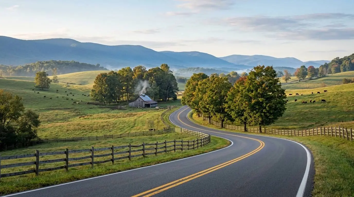
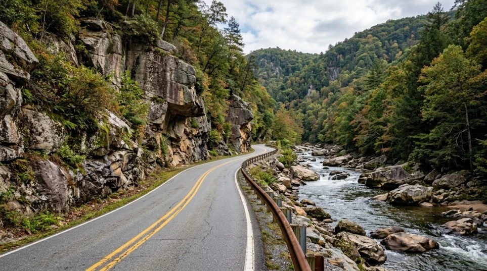
    Stretching north-south through the high mountain valleys of Allegheny Highland country, the Route 220 Highland to Bath Counties motorcycle guide highlights one of Virginia’s most scenic valley corridors. Connecting Monterey—the heart of Virginia’s maple country—to Warm Springs and Hot Springs in Bath County, US Route 220 follows the tranquil course of the Jackson River. Featuring long sweeping bends, gentle rolling grades, pristine farm pastures, and towering mountain ridges on both horizons, Route 220 offers a smooth, relaxed alpine valley ride.

    Key Riding Highlights & Route 220 Conditions

    Navigating this pristine mountain valley corridor requires attention to rural roadway characteristics and wildlife activity:

    • 1. Jackson River Sweepers and Smooth Rhythm:
      Following the Jackson River valley, US 220 delivers long, flowing turns with excellent sightlines. The asphalt quality is exceptionally smooth, offering a relaxed touring cadence between high-elevation mountain passes.
    • 2. Free-Range Farm Animals and Rural Machinery:
      Highland and Bath counties are rural, agricultural communities. Stay alert for livestock near unfenced pasture edges, tractor traffic entering from gravel farm lanes, and slow-moving agricultural transport vehicles.
    • 3. High Deer and Wildlife Crossing Density:
      The river bottom along Route 220 attracts dense populations of whitetail deer and wild turkeys. Exercise extreme caution during early morning and twilight hours when animals frequently cross the highway to reach water sources.
    • 4. Shaded River Bends and Early Morning Frost:
      In spring and late autumn, cool air settles in the Jackson River valley. Deeply shaded turns near riverbanks can retain morning frost or dampness long after higher ridge roads have dried.
    Route 220 Highland to Bath Counties motorcycle guide showing a scenic highway along the Jackson River valley in Virginia.
    US Route 220 winds through the peaceful Jackson River valley connecting Monterey and Warm Springs.

    Before taking on mountain valley routes, perform a complete pre-ride inspection using the complete pretrip motorcycle maintenance guide. Maintain optimal tire pressure and tread grip for river valley asphalt with motorcycle tire pressure and tread maintenance for mountain curves and slick asphalt. If connecting to eastern mountain passes, review route tips in route 39 virginia highlands motorcycle guide.

    Conclusion: The Premier Allegheny Valley Byway

    Studying this Route 220 Highland to Bath Counties motorcycle guide equips riders to safely experience the tranquil beauty of Western Virginia’s high country. Delivering serene river views, smooth cornering rhythm, and historic mountain village stops, Route 220 is a cornerstone corridor for Appalachian backroad touring.

    Legal Disclaimer: This guide is provided for educational and route-planning purposes only. Always observe posted speed limits, yield to farm traffic, and ride within your capabilities.

    Official & Credible Sources


    Enjoyed This Guide? Explore Related Virginia Touring Resources:

    1. Highland Mountain Loops: Explore alpine passes on highland county maple and mountain loop guide.
    2. Highland Canyon Passes: Ride dramatic river gorges in route 39 virginia highlands motorcycle guide.
    3. Pre-Trip Safety: Inspect your motorcycle systems prior to valley tours using the complete pretrip motorcycle maintenance guide.
    4. Tire Maintenance: Optimize cold tire pressure for shaded river bends with motorcycle tire pressure and tread maintenance for mountain curves and slick asphalt.
    5. Valley Connectors: Explore central valley sweeps on route 250 waynesboro to staunton motorcycle guide.

  • Route 39 Virginia Highlands Motorcycle Guide (2026)

    Route 39 Virginia Highlands Motorcycle Guide (2026)


    Winding through the wild, high-country landscape of Rockbridge and Bath counties, the Route 39 Virginia Highlands motorcycle guide explores one of western Virginia’s most stunning mountain corridors. Known as the Appalachian Waters Scenic Byway, Virginia Route 39 connects Lexington to the West Virginia state line near Mountain Grove, continuing on as WV 39 toward Marlinton. Highlighting the dramatic river gorge of Goshen Pass, a steady climb west toward Warm Springs, and peaceful highland valleys in Bath County, Route 39 delivers an exceptional mix of rugged natural scenery, deep river canyons, and tight technical cornering.

    Key Riding Highlights & Route 39 Conditions

    Tackling the river gorges and mountain passes of Route 39 requires sharp technical riding skills:

    • 1. Carving the Rocky Gorge of Goshen Pass:
      The eastern segment of Route 39 cuts directly through Goshen Pass, a roughly four-mile gorge carved by the Maury River. Expect tight, technical curves bounded by rock cliffs and riverbanks. Watch for damp pavement in shaded rock cuts.
    Virginia Route 39 curving through the rocky river gorge of Goshen Pass
    Route 39 hugs the Maury River through the tight, rock-bound curves of Goshen Pass.
    • 2. Climbing West Toward Warm Springs:
      West of Goshen, Route 39 climbs through a series of mountain grades on its way to Warm Springs. This section features continuous curves and elevation changes. Maintain smooth throttle control and stay within your lane on blind bends.
    Winding mountain curves on Virginia Route 39 west of Goshen toward Warm Springs
    West of Goshen, Route 39 climbs through a steady series of forested curves toward Warm Springs.
    • 3. Watch for Falling Rock and River Debris:
      Because Route 39 hugs steep rock faces along Goshen Pass and mountain cuts, loose gravel, small rocks, and seasonal water runoff can wash across the asphalt. Keep scanning far ahead around cliffside bends.
    Loose rocks and gravel along a rock-cut mountain road shoulder on Virginia Route 39
    Loose rock and gravel can wash onto the roadway near cliffside cuts on Route 39.
    • 4. Limited Services in Remote Bath County:
      Bath County is one of Virginia’s most sparsely populated regions. Cell coverage is intermittent, and gas stations are widely spaced. Fill your tank in Lexington or Warm Springs before venturing into high-elevation passes.
    Quiet remote road through the forested mountains of Bath County, Virginia
    Bath County’s sparse population means long stretches with no fuel stations or cell service.

    Before embarking on remote mountain passes, execute a full pre-ride inspection using the complete pretrip motorcycle maintenance guide. Ensure maximum edge grip for tight canyon curves with motorcycle tire pressure and tread maintenance for mountain curves and slick asphalt. If connecting to valley highways, review route 250 waynesboro to staunton motorcycle guide.

    Conclusion: Western Virginia’s Rugged Mountain Masterpiece

    Studying this Route 39 Virginia Highlands motorcycle guide prepares riders to take on one of the Mid-Atlantic’s finest Appalachian byways. With a dramatic river canyon, challenging mountain grades, and serene highland scenery, Route 39 is a bucket-list destination for technical motorcycle touring.

    Legal Disclaimer: This guide is provided for educational and travel planning purposes only. Always observe posted speed limits, manage cornering speeds through mountain passes, and ride within your abilities.

    Official & Credible Sources


    Enjoyed This Guide? Explore Related Virginia Touring Resources:

    1. Valley Connectors: Tour rolling agricultural highways on route 250 waynesboro to staunton motorcycle guide.
    2. Hidden Mountain Loops: Explore secluded national forest roads on fort valley and massanutten mountain motorcycle loop guide.
    3. Pre-Trip Maintenance: Perform mechanical checks before backcountry rides using the complete pretrip motorcycle maintenance guide.
    4. Tire Maintenance: Optimize cold tire pressure for canyon curves with motorcycle tire pressure and tread maintenance for mountain curves and slick asphalt.
    5. Mountain Pass Access: Experience dual-lane climbs on us route 33 swift run gap motorcycle guide.

  • Fort Valley & Massanutten Motorcycle Loop Guide: VA (2026)

    Fort Valley & Massanutten Motorcycle Loop Guide: VA (2026)

    Encased within a unique double-ridge mountain valley in the George Washington National Forest, the Fort Valley and Massanutten Mountain motorcycle loop guide introduces riders to one of the northern Shenandoah Valley’s most secluded natural corridors. Accessible from the north via Virginia Route 678 off Route 55 between Strasburg and Front Royal, Fort Valley runs down the center of Massanutten Mountain, with Passage Creek flowing through the valley floor and exiting through a narrow gorge at the northeast end. With tight, shaded curves, dense forest canopy, and small creek crossings, Fort Valley offers a peaceful, low-traffic alternative to high-ridge national parkways.

    Key Riding Highlights & Fort Valley Conditions

    Navigating the narrow gaps and densely forested floor of Fort Valley requires focused backroad awareness:

    1. Master the Tight, Shaded Curves Near Passage Creek:
    The northern end of Fort Valley near Elizabeth Furnace narrows where Passage Creek cuts through the mountain. These shaded turns demand smooth lean angles, precise speed control, and constant sightline scanning.

    Stone bridge over Passage Creek beside a curving forest road in Fort Valley, Virginia
    Tight, shaded curves and creek crossings near Passage Creek demand smooth lean angles and precise speed control.

    2. Watch for Gravel Runoff and Damp Asphalt:
    Because Fort Valley is heavily shaded by national forest canopy, pavement dampness can linger well into the afternoon. Gravel from forest service roads and trailhead pull-offs can wash into turn apexes after rain.

     Whitetail deer at the edge of a misty forest road in Fort Valley, Virginia
    Deer are common along Fort Valley’s forest corridors, especially at dawn and dusk.

    3. Expect Hikers, Cyclists, and Wildlife:
    Recreation areas such as Elizabeth Furnace draw hikers, campers, anglers, and cyclists, and the surrounding forest is home to whitetail deer, wild turkeys, and black bears. Keep speeds conservative around blind curves, especially in early morning and late afternoon.

    Whitetail deer at the edge of a misty forest road in Fort Valley, Virginia
    Deer are common along Fort Valley’s forest corridors, especially at dawn and dusk.

    4. Limited Fuel and Cellular Service:
    Cellular coverage can be sparse inside the valley, and fuel stations are generally not available along Route 678. Top off your tank in Front Royal or Strasburg before entering, and confirm surface conditions before using any gap roads out of the valley, since some forest roads nearby are gravel or dirt.

    Remote paved road through a forested mountain valley in Virginia with no fuel stations or buildings in sight
    Fuel and cell service are limited in Fort Valley, so fill up before entering.

    Before exploring isolated forest valleys, perform a complete pre-ride mechanical check using the complete pretrip motorcycle maintenance guide. Ensure correct tire cold inflation pressure and tread depth for shaded forest roads with motorcycle tire pressure and tread maintenance for mountain curves and slick asphalt. If connecting your loop to neighboring valley highways, review luray and page county motorcycle ride guide.

    Conclusion: The Shenandoah Valley’s Hidden Mountain Refuge

    Studying this Fort Valley and Massanutten Mountain motorcycle loop guide equips riders to safely navigate one of the Mid-Atlantic’s most tranquil mountain valleys. Delivering quiet forest scenery, tight shaded curves, and a peaceful pace, Fort Valley is a true hidden gem for backroad riders.

    Legal Disclaimer: This guide is provided for educational and route-planning purposes only. Always observe posted speed limits, account for limited cell coverage, and ride within your capabilities.

    Official & Credible Sources


    Enjoyed This Guide? Explore Related Virginia Touring Resources:

    1. Valley Connectors: Tour nearby Page Valley backroads in luray and page county motorcycle ride guide.
    2. Parkway Ridge Routes: Experience national park highways on skyline drive northern section motorcycle guide.
    3. Pre-Trip Safety: Inspect your mechanical systems before backcountry rides using the complete pretrip motorcycle maintenance guide.
    4. Tire Maintenance: Maintain edge traction on shaded forest asphalt with motorcycle tire pressure and tread maintenance for mountain curves and slick asphalt.
    5. Valley Highway Sweepers: Explore broader agricultural corridors on route 250 waynesboro to staunton motorcycle guide.