Category: Scenic Riding Trails

  • George Washington & Jefferson National Forest Motorcycle Routes 2026

    George Washington & Jefferson National Forest Motorcycle Routes 2026

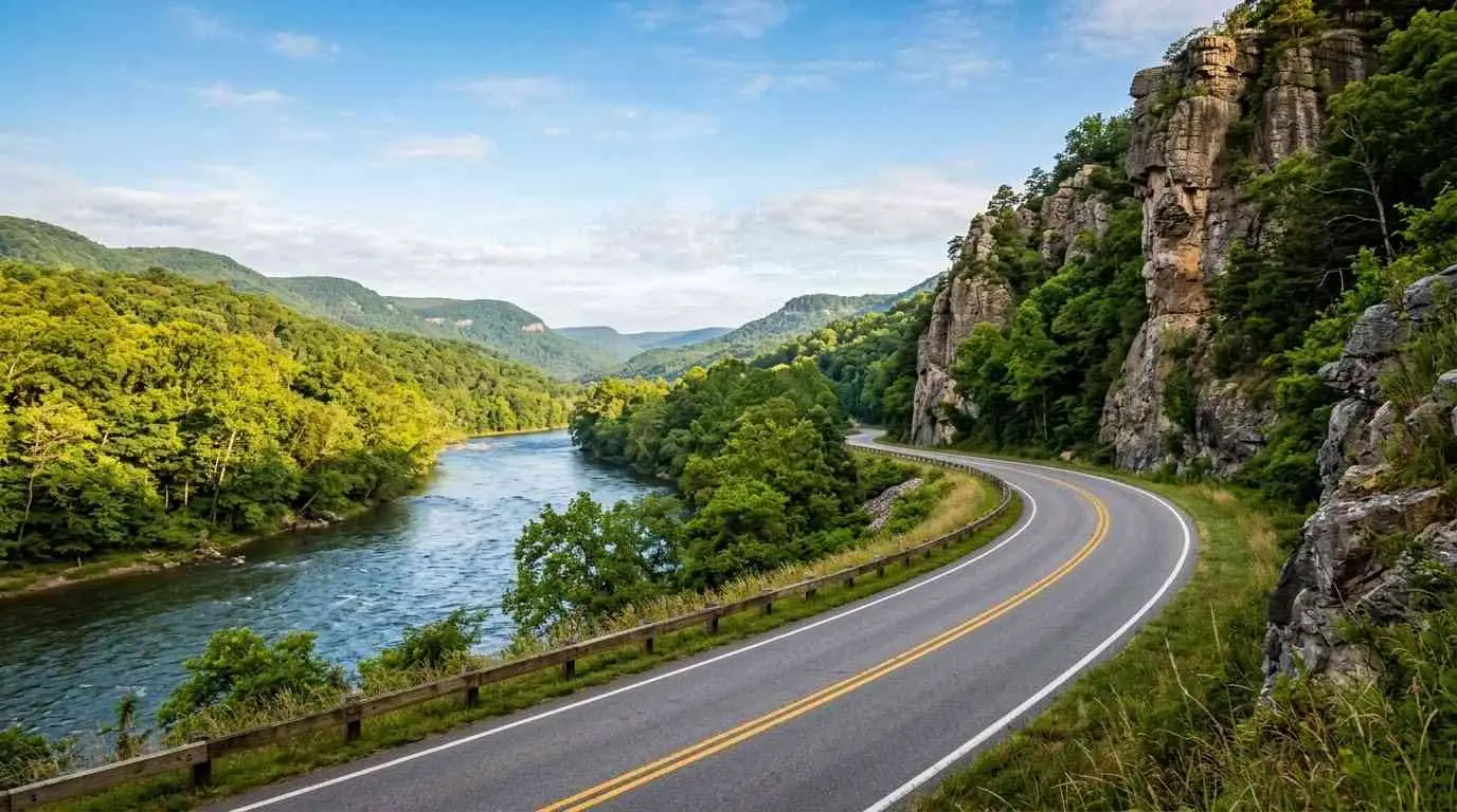
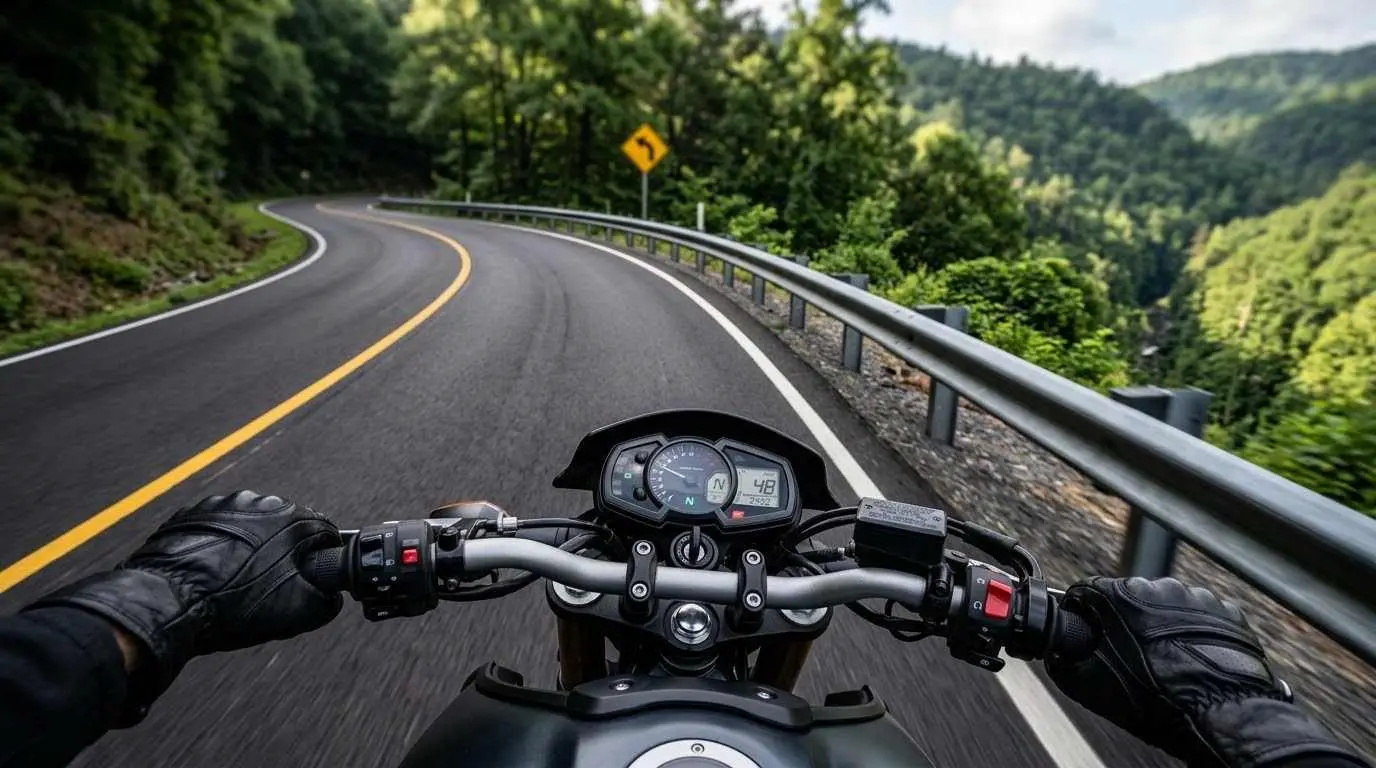
    Spanning over 1.8 million acres across the rugged Ridge-and-Valley Appalachians, the combined George Washington and Jefferson National Forests offer some of the most spectacular, uninterrupted backroad riding in Eastern North America. Far removed from commercial highway traffic, these forested corridors weave through dense timber, deep mountain gaps, and sweeping valley ridges. Exploring George Washington Jefferson National Forest motorcycle routes gives riders a perfect blend of technical elevation changes, smooth tarmac sweepers, and pristine mountain solitude.

    Top Forest Corridors & Iconic Mountain Loops

    Navigating this vast federal forest area is best experienced by linking together its most famous mountain passes:

    • Route 39 (Maury River Canyon & Warm Springs Mountain): Carving through the northern section of the forest, Route 39 follows the rushing waters of the Maury River through a dramatic limestone gorge before climbing steeply up Warm Springs Mountain. It delivers rapid corner transitions mixed with stunning canyon walls.
    • Route 250 (Shenandoah Mountain Pass): Crossing directly west from Churchville toward West Virginia, Route 250 tackles a series of hairpin switchbacks as it climbs over Shenandoah Mountain. This route provides high-elevation ridge views and steep descent control tests.
    • Route 16 (Back of the Dragon Section): Located in the southern Jefferson National Forest region, this legendary 12-mile stretch features over 320 curves. It stands as a premier technical challenge for riders seeking precise cornering feedback.
    • Route 56 (Tye River Gap & Crabtree Falls): A tight, highly technical climb that scales the Blue Ridge crest, passing near Crabtree Falls. It demands total focus on throttle control and smooth lean angles.

    Essential Tips for Riding the Forest Passes

    Riding through deep federal forest corridors presents unique environmental conditions that require smart preparation:

    1. Watch for Micro-Climate Temperature Drops: Deep forest canopy blocks sunlight, keeping pavement temperatures significantly colder than open valleys. Expect damp asphalt in shaded mountain hollows long after morning dew has lifted.
    2. Beware of Roadside Gravel & Forest Debris: Heavy rains frequently wash loose shale, mountain gravel, and fallen tree branches directly into apex turns along uncurbed forest roads. Maintain a wider entry line into blind curves to preserve your visual lead.
    3. Plan Around Fuel & Cellular Gaps: Cellular signal drops completely in many isolated forest valleys. Top off your gas tank in hub towns like Lexington, Covington, or Harrisonburg, and ensure you download offline GPS maps before heading into the mountains.
    4. Respect Wildlife Corridors: Black bears, white-tailed deer, and wild turkeys frequently cross forest routes during early morning and late afternoon hours. Maintain moderate speeds through heavily wooded stretches.

    Exploring George Washington Jefferson National Forest motorcycle routes delivers a pure, thrilling connection to Virginia’s backcountry. By keeping an eye on road surface shifts, managing fuel range, and respecting mountain wildlife, you can enjoy an unforgettable ride through the heart of the Appalachian wilderness.

    Legal Disclaimer: This guide is provided for educational and travel planning purposes only. Forest road conditions, weather closures, and maintenance status can change rapidly. Always check official U.S. Forest Service or VDOT 511 travel advisories before embarking on your ride.

    Official & Credible Sources

  • Avoiding Deer Collisions: Motorcycle Safety in Rural Virginia 2026

    Avoiding Deer Collisions: Motorcycle Safety in Rural Virginia 2026

    Rural Virginia’s scenic backroads—stretching through the Shenandoah Valley, Piedmont region, and Appalachian foothills—offer incredible riding, but they also present one of the state’s most frequent hazards: white-tailed deer. According to wildlife collision data, Virginia consistently ranks among the top states for animal-vehicle strikes, with peak activity occurring during autumn mating season (rut) and spring feeding periods. Prioritizing tactics for avoiding deer collisions to maintain motorcycle safety in rural Virginia is critical for every rider navigating forested corridors, unlit highways, and agricultural routes after dark.

    Quick Inspection Checklist

    Hazard ParameterPrimary Threat StandardTactical Mitigation Action
    Focus KeywordAvoiding Deer Collisions Motorcycle Safety in Rural VirginiaUsed in Title, Intro, H2s, & Meta
    Peak Hazard HoursCrepuscular periods (Dusk & Dawn)Reduce speed by 10–15 mph; enhance visual scanning
    High-Risk SeasonsFall Rut (Oct–Dec) & Spring (Apr–May)Increase lane buffer distance; use lead vehicles
    Eye-Shine ScanningRetro-reflective eye reflection in ditchesScan 12–15 seconds ahead along shoulder tree lines
    Braking ResponseSudden roadside animal emergenceMaximum straight-line braking; avoid aggressive swerving

    White-tailed deer behavior on rural Virginia backroads is notoriously unpredictable. Understanding their natural movement patterns allows riders to anticipate hazards before an animal jumps into the roadway.

       [ FOREST EDGE / DITCH CORRIDOR ]
                     │
                     ▼
    ┌──────────────────────────────────┐
    │ Crepuscular Feed Time (Dusk/Dawn)│  ◄── High Activity Window
    └────────────────┬─────────────────┘
                     │
                     ▼
    ┌──────────────────────────────────┐
    │ Spot Eye-Shine Reflection        │  ◄── 12-15 Second Visual Scanning
    └────────────────┬─────────────────┘
                     │
                     ▼
    ┌──────────────────────────────────┐
    │ Immediate Speed Reduction        │  ◄── Prepare for Herd Follow-Through
    └────────────────┬─────────────────┘
                     │
                     ▼
       [ CONTROLLED STRAIGHT-LINE STOP ]

    Because white-tailed deer travel in family units, seeing a single animal cross the asphalt usually indicates that a second or third deer is following right behind it.

    1. Identify High-Risk Zones & Peak Time Windows

    Deer collisions spike during specific seasonal and daily intervals across rural Virginia:

    • The Crepuscular Danger Zone: Deer are most active during dusk (5 PM–9 PM) and dawn (5 AM–8 AM), when lower ambient light reduces human peripheral vision.
    • Seasonal Peak (The Rut): October through December marks the annual mating season. Bucks actively chase does across highways, completely ignoring vehicle traffic.
    • Corridor Identification: Pay close attention to agricultural field edges, creek crossings, and areas marked with official VDOT deer crossing warning signs.

    2. Master Peripheral Eye-Shine & Shadow Scanning

    Detecting an animal before it leaps onto the asphalt is the single best way to prevent a crash:

    • Look for Eye-Shine: Human eyes spot retro-reflective tapetum lucidum glint (glowing eyes) from hundreds of feet away. Scan ditches and forest edges continuously.
    • Watch for “Moving Shadows”: On dark roads, look for breaks in tree-line shadows or headlight beams flickering through roadside brush.
    • High-Beam Optimization: Use high beams whenever oncoming traffic permits to illuminate tree canopies and shoulders.

    3. Apply the “Second Deer Rule” Immediately

    One of the most common mistakes riders make is resuming speed after one deer clears the road:

    • Expect the Herd: Deer are herd animals. If one jumps across your lane, assume another is right behind it.
    • Complete Deceleration: Bring the motorcycle to a manageable speed or a complete stop until you are 100% sure no trailing deer are waiting in the brush.

    4. Execute Emergency Straight-Line Braking

    When an animal pops out directly in front of your motorcycle, reaction time is limited:

    • Brake Firmly in a Straight Line: Apply maximum front and rear brake pressure without locking up wheels. Keeping the bike upright maximizes tire traction.
    • Avoid Aggressive Swerving: Swerving at high speeds on rural roads often leads to losing traction on gravel shoulders, running into oncoming traffic, or striking roadside trees.
    • Sound the Horn: Give a long, steady blast of your horn. Short quick beeps may startle the animal into freezing in your path.

    5. Utilize Lead Vehicles as Protective Buffers

    Let four-wheeled vehicles clear the path ahead on unlit rural highways:

    • Maintain Safety Distance: Follow behind a car or truck at a safe 3-to-4-second cushion.
    • Observe Brake Lights: Use the lead vehicle’s headlights to spot distant hazards. If their brake lights illuminate, slow down immediately.

    Prioritizing avoiding deer collisions for motorcycle safety in rural Virginia requires active scanning, speed management, and disciplined braking. By staying alert during peak twilight hours and understanding herd behavior, you can enjoy Virginia’s scenic rural roads safely.

    Legal Disclaimer: This guide is for educational and informational purposes only. Wildlife movements are unpredictable. Always ride within your skill limits, obey posted speed limits, and wear full protective gear.

    Official & Credible Sources

    • Virginia Department of Wildlife Resources (DWR) Deer Safety: https://dwr.virginia.gov
    • Virginia Department of Transportation (VDOT) Safety Programs: https://www.virginiadot.org
    • Motorcycle Safety Foundation (MSF) Hazard Management: https://msf-usa.org

  • Blue Ridge Parkway Virginia Motorcycle Guide: 5 Must-Ride Gaps

    Blue Ridge Parkway Virginia Motorcycle Guide: 5 Must-Ride Gaps

    Blue Ridge Parkway Virginia Motorcycle Guide: 5 Must-Ride Gaps

    Known as “America’s Favorite Drive,” the Virginia section of the Blue Ridge Parkway stretches over 200 miles from Rockfish Gap down to the North Carolina state line. Designed specifically for recreational touring, this pristine, commercial-free mountain corridor features zero stoplights and hundreds of sweeping turns.

    Following a complete Blue Ridge Parkway Virginia motorcycle guide ensures you navigate high-elevation gaps, weather shifts, and fuel stops efficiently.

    Quick Parkway Ride Essentials:

    • Speed Limit: Strictly 45 mph for maximum safety and scenery.
    • Commercial Traffic: Completely prohibited; smooth pavement throughout.
    • Fuel Access: No gas stations directly on the parkway; off-ramp planning needed.
    • Elevation Range: Rises from 650 feet to over 3,900 feet in Virginia.
    • Wildlife Protection: High deer and bear activity near forest cuts.

    Mastering High-Elevation Mountain Curves

    The Parkway is famous for its smooth, sweeping curves rather than sharp switchbacks. However, mountain fog, sudden rain showers, and leaf debris in autumn require disciplined speed control and smooth throttle inputs.

    Parkway Section Progression:

    [ Rockfish Gap (Milepost 0) ] ──> [ Peaks of Otter (MP 86) ] ──> [ Mabry Mill (MP 176) ]
    │ │ │
    ▼ ▼ ▼
    (Northern Gateway) (High Peak Elevation) (Historic Landmark)

    5 Highlight Stops Along the Virginia Parkway

    1. Humpback Rocks (Milepost 6)
      Located near the northern start, this stop offers dramatic rock formations and early vistas of the Shenandoah Valley floor.
    2. James River Visitor Center (Milepost 63)
      The lowest elevation point on the parkway, offering a scenic river bridge crossing and shaded resting areas under mature hardwoods.
    3. Peaks of Otter (Milepost 86)
      Surrounded by twin mountain peaks and a serene lake, this is an ideal midpoint stop for lunch, lodge relaxation, and fuel access off the ramp.
    4. Smart View Recreation Area (Milepost 154)
      True to its name, this peaceful overlook offers panoramic views of the Piedmont plateau and historic log structures.
    5. Historic Mabry Mill (Milepost 176)
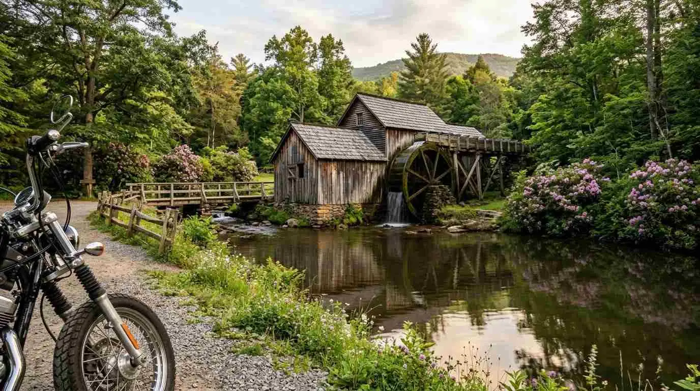
      One of the most photographed historic structures along the route, featuring a preserved water-powered gristmill and shaded resting pads.

    Conclusion: Ride America’s Premier Mountain Highway

    The Blue Ridge Parkway provides a pure, uninterrupted motorcycling experience through Virginia’s southern highlands. Maintain your line, watch for sudden mountain mist, and savor every turn.

    Smooth throttle. Watch the fog. Enjoy the Parkway.

    References & Sources

    • National Park Service (NPS) — Blue Ridge Parkway Road Conditions & Maps — nps.gov
    • Virginia Tourism Corporation — Blue Ridge Mountain Touring Routes — virginia.org
    • Blue Ridge Parkway Association — Visitor & Rider Travel Directory — blueridgeparkway.org

    [Disclaimer: This article is provided for informational, inspirational, and educational purposes only. Weather closures and maintenance detours occur frequently on mountain passes. Check official National Park Service advisories prior to travel.]

    Enjoyed This Guide? Explore More Virginia Riding Resources:

    If you found this article helpful, dive deeper into our top-recommended guides to stay safe, well-equipped, and ready for your next Appalachian adventure:

    1. State Legal Rules & Safety Regulations: Stay fully compliant on state highways with our updated overview of Virginia motorcycle laws 2026 helmets lane splitting and regulations (https://motorcyclevirginia.com/virginia-state-motorcycle-laws-2026-helmets-lane-splitting-and-regulations/).
    2. Technical Mountain Routes: Tackle 320 sharp switchbacks across Southwest Virginia using our Virginia State Route 16 complete riding guide to the Back of the Dragon (https://motorcyclevirginia.com/virginia-state-route-16-riding-guide-back-of-the-dragon/).
    3. Long-Distance Trip Prep: Ensure your bike is 100% mechanically prepped before heading out with how to prepare your motorcycle for long-distance touring (https://motorcyclevirginia.com/how-to-prepare-your-motorcycle-for-long-distance-touring/).
    4. DIY Brake & Safety Maintenance: Keep your stopping power at peak performance with our hands-on guide to motorcycle brake pad replacement DIY step-by-step maintenance (https://motorcyclevirginia.com/motorcycle-brake-pad-replacement-diy-step-by-step-maintenance/).
    5. Group Intercom Tech Reviews: Upgrade your helmet comms for group rides by comparing Cardo vs Sena choosing the best motorcycle intercom for group rides (https://motorcyclevirginia.com/cardo-vs-sena-choosing-the-best-motorcycle-intercom-for-group-rides/).
  • Virginia Beach Coastal Motorcycle Rides: Top 5 Ocean Routes

    Virginia Beach Coastal Motorcycle Rides: Top 5 Ocean Routes

    Virginia Beach Coastal Motorcycle Rides: Top 5 Ocean Routes

    Cruising the oceanfront and coastal bays of Southeast Virginia delivers a riding experience unlike any other in the Commonwealth. Combining flat, open stretches of smooth asphalt, refreshing Atlantic sea breezes, and stunning waterfront vistas, Virginia Beach serves as the ultimate launching point for coastal touring.

    Navigating Virginia Beach coastal motorcycle rides requires an understanding of coastal traffic patterns, salt-air maintenance, and the best bridge-tunnel crossings along the Atlantic shoreline.

    Quick Coastal Route Highlights:

    • Atlantic Avenue & Oceanfront: Classic resort-strip cruising with sea views.
    • Shore Drive (Route 60): Scenic canopy ride along First Landing State Park.
    • Chesapeake Bay Bridge-Tunnel: 23-mile engineering marvel over open water.
    • Sandbridge Road: Quiet, rural marshland access to Southern Outer Banks.
    • Pungo Agricultural Loop: Peaceful farmland sweeping roads near the coast.

    Navigating Atlantic Coast Winds and Marine Air

    Riding near ocean corridors presents unique conditions. Crosswinds along open bay bridges demand a relaxed grip and defensive body positioning, while salt mist requires post-ride freshwater rinsing to protect your machine’s chrome and aluminum finishes.

    Coastal Touring Route Flow:

    [ Shore Drive Corridor ] ──> [ Oceanfront Boulevard ] ──> [ Sandbridge Marshes ]
    │ │ │
    ▼ ▼ ▼
    (Maritime Forest View) (Atlantic Ocean Vistas) (Quiet Country Roads)

    Top 5 Coastal Routes to Explore

    1. The Atlantic Avenue Oceanfront Cruise
      Experience the heart of the resort city by cruising along Atlantic Avenue. This slow-paced route is perfect for evening rides, offering easy access to local seafood dining and coastal atmosphere.
    2. Shore Drive through First Landing State Park
      Connecting the Bayfront to the Oceanfront, Shore Drive weaves past live oak tree canopies and Spanish moss, providing shade and cool breezes along First Landing State Park.
    3. The Historic Pungo Agricultural Loop
      Head south of the city center into Pungo. This peaceful loop takes you through historic family farms, local berry stands, and wide-open rural highways with minimal traffic.
    4. Sandbridge Road to Little Island
      Escape the city bustle by following Sandbridge Road down to the untouched dunes of Sandbridge Beach. The road sweeps gracefully alongside marshlands and tidal creeks.
    5. Chesapeake Bay Bridge-Tunnel Passage
      For riders seeking an unforgettable bridge crossing, taking US-13 over the mouth of the Chesapeake Bay offers 23 miles of open water views connecting to Virginia’s Eastern Shore.

    Conclusion: Enjoy the Coastal Highway Breeze

    ​From oceanfront promenades to quiet salt-marsh backroads, Virginia Beach offers exceptional coastal touring options for every style of rider. Before setting out on long coastal runs, ensure your machine is mechanically ready by reviewing our guide on how to prepare your motorcycle for long-distance touring, and carry a compact emergency repair setup as outlined in the complete pre-trip motorcycle maintenance guide. Additionally, make sure your helmet and bike equipment meet state regulations by checking Virginia motorcycle laws 2026 helmets lane splitting and regulations. Pack your sunglasses, rinse your bike after the ride to protect against ocean salt, and enjoy the views.

    ​Rinse the salt. Feel the breeze. Cruise the coast.

    References & Sources

    • Virginia Department of Transportation (VDOT) — Hampton Roads Bridges & Tunnels Info — virginiadot.org
    • Virginia Beach Convention and Visitors Bureau — Coastal Travel Guides — visitvirginiabeach.com
    • National Oceanic and Atmospheric Administration (NOAA) — Coastal Weather Advisories — noaa.gov

    [Disclaimer: This article is provided for informational, inspirational, and educational purposes only. Bridge tolls, coastal weather advisories, and seasonal resort traffic restrictions vary. Always check official local transportation updates before riding.]

  • Top 5 Scenic Motorcycle Routes in the Shenandoah Valley

    Top 5 Scenic Motorcycle Routes in the Shenandoah Valley

    Top 5 Scenic Motorcycle Routes in the Shenandoah Valley Nestled between the Blue Ridge Mountains to the east and the Allegheny Mountains to the west, the Shenandoah Valley is widely considered a touring paradise for motorcyclists. With miles of impeccably paved asphalt, dramatic elevation changes, and continuous valley vistas, this region offers an unmissable riding experience in Virginia.Whether you prefer leisurely cruising past historic farmlands or tackling sharp mountain switchbacks, exploring the top 5 scenic motorcycle routes in the Shenandoah Valley guarantees unforgettable miles on two wheels.

    1. Skyline Drive

    The Crown JewelStretching 105 miles along the crest of the mountains, Skyline Drive is the quintessential Shenandoah journey. Offering 75 scenic overlooks, this route delivers sweeping panoramas of the valley floor below. With a relaxed 35 mph speed limit, it provides the ultimate leisurely ride through dense forest canopy and high-elevation gaps.

    2. Route 211 through Thornton Gap

    For riders seeking technical curves and engaging elevation gains, US Route 211 climbing up to Thornton Gap is a must. Featuring smooth pavement and wide double-climbing lanes, this mountain pass allows touring riders to lean into crisp, sweeping turns while ascending toward the Shenandoah ridge.

    3. Fort Valley Road (Route 678)

    Tucked neatly between Massanutten Mountain ridges, Route 678 offers a peaceful backroad escape through Passage Creek gorge. This secluded stretch features gentle curves, forested shadows, and classic Virginia countryside charm, making it ideal for a relaxed afternoon ride away from highway traffic.

    4. Route 33 over Swift Run Gap

    Connecting Harrisonburg to the eastern slopes, Route 33 delivers a dynamic mix of sharp hairpins and wide mountain vistas. The ascent up Swift Run Gap tests your throttle control and line selection, rewarding riders with breathtaking overlooks near the mountain summit.

    5. Route 11 the Historic Valley Pike

    Running parallel to Interstate 81, historic Route 11 offers a classic, small-town touring experience. Passing through charming mountain towns like Lexington, Staunton, and Woodstock, this historic corridor combines rolling agricultural hills with easy access to local diners and historic landmarks.

    Plan Your Shenandoah Escape: From high-altitude ridge rides to quiet valley corridors, riding through the Shenandoah Valley offers unmatched natural beauty and diverse road layouts. Before setting out, ensure your machine is fully prepped by following our guide on how to prepare your motorcycle for long-distance touring, monitor seasonal mountain weather, and observe local speed limits alongside safety guidelines outlined in Virginia motorcycle laws 2026 helmets lane splitting and regulations. If you plan to extend your trip into an overnight adventure, review our top recommendations for motorcycle camping in Virginia top campsites and route planning. Choose your route. Respect the curves. Enjoy the valley.

    [Disclaimer: This article is provided for informational, inspirational, and educational purposes only. Road conditions, seasonal closures, speed limits, and weather patterns along Virginia mountain passes are subject to change. Always check official local transit reports and park alerts before setting out on your ride.]

    References & Sources :

    * Virginia Department of Transportation (VDOT) — Scenic Byways & Travel Advisories — virginiadot.org

    * National Park Service (NPS) — Shenandoah National Park Driving Guides — nps.gov

    * Virginia Tourism Corporation — Shenandoah Valley Touring Routes — virginia.org

  • Riding the Blue Ridge Parkway: The Ultimate Virginia Motorcycle Guide

    Riding the Blue Ridge Parkway: The Ultimate Virginia Motorcycle Guide

    If you ride on two wheels, the Blue Ridge Parkway is not just another stretch of asphalt—it is an unforgettable journey through the heart of Virginia’s Appalachian Mountains. Known as “America’s Favorite Drive,” this scenic highway offers world-class riding conditions that every motorcycling enthusiast should experience at least once.

    1. What Makes the Blue Ridge Parkway a Premier Riding Destination?

    1.1. Unrivaled Scenic Views and Sweeping Curves:

    The Parkway spans hundreds of miles without a single commercial vehicle or traffic light. This creates a continuous, fluid riding flow surrounded by lush mountain peaks, deep valleys, and forest canopy that changes color dramatically across the seasons.

    1.2. Technical Riding and Elevation Changes:

    Engineered specifically for recreational travel, the road features smooth, banked curves. However, riders must stay alert: sudden elevation changes, blind turns, and decreasing-radius curves require proper speed management and sharp throttle control.

    2. Essential Rules and Speed Limits on the Parkway

    2.1. Adhering to the Speed Limit:

    The maximum speed limit along most of the Parkway is 45 mph (72 km/h), with lower limits near popular overlooks. Riding at this speed is not a restriction—it allows you to navigate sharp turns safely while enjoying the breathtaking terrain.

    2.2. Wildlife Hazards and Road Awareness:

    Virginia’s mountain corridors are home to white-tailed deer, wild turkeys, and black bears. Wildlife activity peaks at dawn and dusk, so maintaining a conservative buffer distance is essential for your safety.

    3. Practical Tips Before You Hit the Road

    3.1. Fueling Strategy and Off-Parkway Stops:

    There are no gas stations directly on the Blue Ridge Parkway itself. You must exit onto intersecting state routes to find fuel in nearby towns. A reliable rule of thumb is to top off your tank whenever it drops to half capacity.

    3.2. Packing for Rapid Elevation and Weather Shifts

    Temperatures at higher elevations can drop 10°F to 15°F compared to the valleys below. Dense fog can also roll in without warning. Dressing in versatile layers and carrying clear-visor helmets will keep you comfortable and visible.

    References & Sources:

    National Park Service (NPS) – Official Blue Ridge Parkway Regulations & Conditions.

    Virginia Department of Motor Vehicles (DMV) – Virginia Motorcycle Operator Manual.

    [Disclaimer:The information provided in this article is for educational and informational purposes only. Road conditions, park rules, and local regulations change frequently. Always check the official National Park Service (NPS) updates and Virginia DOT traffic advisories before embarking on your ride.]